Land Grants Concerning McNeills After 1740 and Before 1765
Abstracts of North Carolina Land Patents, Volume One 1735 to 1765
At the time these grants were recorded there was little or no standardized spelling, so concerns about the different spelling of surnames is mostly a waste of time. Also, the “N.W. branch”, “N.W. river” or “N. branch of Cape Fear river” refers to the Cape Fear River itself; the “S.W. side” refers to the west, or Fayetteville, side of the river and “N.E. side” refers to the east side of the river. Entries below are chronological, except where grants were issued on the same day and then the order is by Hofmann's page number.
Page in Hofmann: Grantee: Grant's Description of Land: Notes: Related Deeds/
Subsequent Owners
Page 70
#4156Hector McNeill 4 June 1740. 222 acres in Bladen County beginning at a Hickory in the upper corner of Martin Holts land about nine miles above Rockfish Creek and runs by said Holts land to a pine in the __ line of land Surveyed for John Martinleer then to a Hickory on the River bank then down the River to the first Station.
[Read transcription of the grant]This is , father to Elizabeth McNeill, 'his only child and heir' who married James McNeill of Rockfish Creek in 1752. Half of this tract, located on the east side of the Cape Fear River (CFR) on Dunfield Creek, was sold by James McNeill to Laughlin McNeill in 1755. Laughlin's son James, Jr. sold it in 1803, two years after his father's death. The other half, or perhaps this half, was sold in 1808 by Elizabeth McNeill the wife of James McNeill of Rockfish Creek. The tract included a cemetery in 1803. Cumberland Co.:
1. James McNeill to Lachlen McNeill, 1755.
2. Lauchlan McNeill to Stephen Gilmore, 1800.
3. James McNeill to John McKay, 1803.
4. Elizabeth McNeill to Stephen Gilmore, 1808.Page 285
#4124Neil McNeil 4 June 1740. 400 acres in Bladen County on the N.E. side of the N.W. Branch of Cape Fear, joining the Mouth of a Creek about Six Miles above Fox’s Island.
[Read transcription of the grant]This is "Black Neill" McNeill as identified by the 1755 deed from Hugh Brown to James Thornton, the deed most likely used by historians to claim that "Black Neill" was dead by 1749. Cumberland Co.:
1. Hugh Brown to James Thorton, 1755.Page 285
#4125Malcolm McNeil 4 June 1740. 300 acres in Bladen County on the S.W. side of the N.W. Branch of Cape Fear, joining James Campbell.
[Read transcription of the grant]This is Malcolm McNeill of the Argyll Colony; I know almost nothing so far on this Malcolm though I've found some deeds to his property. He sold this 300 acres before 1748 to John Anderson and through subsequent owners ended up in the hands of Martin Trantham. Eventually it was bought by the sons of "Scribblin Archie" McNeill.. Cumberland Co.:
1. Malcolm McNeill, 1740.
2. James Patterson to Laughlin and Neill McNeill, 1792.Page 285
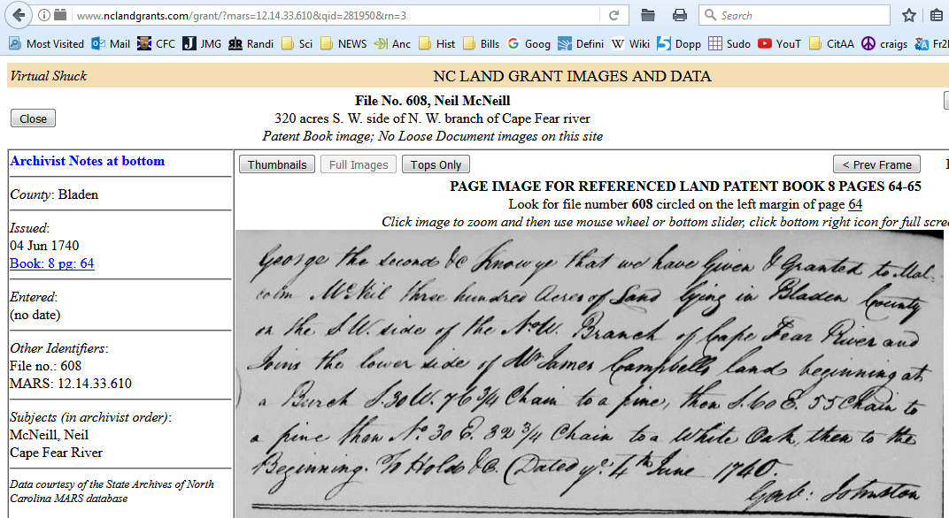
#4126Neil McNeil 4 June 1740. 320 acres in Bladen County on the S.W. side of the N.W. Branch of Cape Fear, joining the river bank about a half mile above the point of the forks.
[Read transcription of the grant]This Neill McNeill is yet to be identified, though I suspect it may be "Black Neill" McNeill, one of the colony's leaders. Per Malcolm Fowler's map of pre-1748 land grants, this tract was located near the fork of Deep and Haw River. Cumberland Co.:
1.Page 285
#4127Daniel McNeil 4 June 1740. 400 acres in Bladen County on the N.E. side of the N.W. Branch of the Cape Fear River, joining the river about three Miles above Fox’s Island. Daniel McNeill of Taynish, one of the leaders of the Argyll Colony. It is unlikely he lived on this tract for long if at all, but did live on a larger 571-acre tract called "Tweedside" that he bought from John Martinleer in 1743 several miles south on east side of CFR near Dunfield Creek. Cumberland Co.:
1.Page 89
#1290Coll McAllister 5 June 1740. 320 acres in Bladen County on the S.W. side of the N.W. Branch of Cape Fear River, joining Neal McNeal about a quarter of a Mile Below the forks.
[Read transcription of the grant]The McAlesters are well researched and documented. I have not attempted to add anything to their existing records. The Neill McNeill mentioned here is as yet unidentified, but was likely "Black Neill" McNeill. 'The forks' mentioned in the description is where the Cape Fear River splits into the Deep and Haw Rivers. Cumberland Co.:
1.Page 203
#2907Archibald McNeil 1 May 1741. 320 acres in Bladen County on the E. side of the N. Branch of the N.W. river, joining the river bank, Torquill McNeill, and the sd. North branch.
[Read transcription of the grant]This Archibald McNeill is 'Scribbling Archie' McNeill, although he would have been around the age of 21 when it was granted to him. In his will of 1801, he left 320 acres 'at the mouth of the hope' in Chatham County to his son Daniel who was in Nova Scotia, so the 320 acres to Daniel is undoubtedly the 1741 grant. Daniel sold this land in 1812 (see link at right). And, since this tract was granted in 1741 it was a grant purchased from the crown, unlikely to have been a grant given in 1740 to new settlers as an inticement to emigrate. Per Malcolm Fowler's map of pre-1748 land grants, this tract was located near the fork of Deep and Haw River in today’s southern Chatham County, NC Chatham Co., NC:
1. Daniel McNeill to William Utley, 1812, Chatham Co., NCPage 367
#3521Hector McNeill 21 May 1741. 640 acres in Bladen County on the E. side of the N.E. Branch of the N.W. river, joining the mouth of Duck Creek, McLaughlan’s land, and the forks of said river.
[Read transcription of the grant]Again, this is "Hector, carver" McNeill. This tract was located on the east side of the fork of Deep and Haw River. However, Fowler's map shows it was granted in 1740 instead of 1741, and he has it placed far above Duck Creek which is on the west side of the river. When Hector sold this 640 acres in 1778 he was living in Bladen County. A deed dated 1741 shows Hector McNeill buying one-half of Turquill's 1741 grant almost immediately after Turquill received the grant. Chatham Co.:
1. Hector McNeill to Valentine Braswell, 1778.Page 166
#2590Neile McNeile 22 May 1741. 320 acres in Bladen County on the E. side of the N. Branch of the N.W. river, joining Hector McNeile and the sd. N.W. branch.
[Read transcription of the grant]This Neill McNeill is yet to be identified. Per Malcolm Fowler's map of pre-1748 land grants, this tract was located near the fork of Deep and Haw River in today’s Harnett County, NC. Cumberland Co.:
1.Page 203
#2908Torquil McNiell 22 May 1741. 320 acres in Bladen County on the E. side of the N. Branch of the N.W. river, joining sd. Branch and Niell McNiell.
[Read transcription of the grant]This Turquill McNeill of the Argyll Colony. Located near the fork of Deep and Haw River. Turquill sold half of this grant to "Hector Carver" McNeill months after he purchased it. Cumberland Co.:
1.Page 3
#6:Hugh McLaughton
[]12 May 1742. 140 acres in Bladen County on the N.E. side of the N.W. Branch of the Cape Fear river, joining Duncan Campbell, Neile McNeile, and the river.
[Read transcription of the grant]Located near the fork of Deep and Haw River. Cumberland Co.:
1.Page 206
#2945Neal McNeal 26 June 1746. 200 acres in Bladen County on the S.W. side of the N.W. Branch of the Cape Fear river, joining the river and (a point) about forty yards below the lower line of Thomas Walker.
[Read transcription of the grant]This is Neill McNeill father of Roger and Henry McNeill. Cumberland Co.:
1.Page 380
#3579Hector McNeill 3 Dec 1746. 200 acres in Bladen County on the S.W. side of the N.W. Branch of the Cape Fear river, joining Watery branch and the upper side of the Lower Little River above the fork of the sd. branch.
[Read transcription of the grant]This is very likely “Hector, carver” McNeill. Cumberland Co.:
1.Cumberland Co. Deed
Bk. 9, p. 413Hector McNeill 7 Apr 1752. 100 acres on Carvers Creek at the confluence of the creek and Cape Fear River.
[Read transcription of the grant]In 1788 this land was sold by Thomas and Jacob Matthews to Farquard Campbell and his son-in-law Thomas Armstrong. The deed spells out the chain of ownership from 'Hector Carver' McNeill to Turquill McNeill to 'Long Duncan' McNeill. Cumberland Co.:
1. Thos. & Jacob Matthews to Farquard Campbell and Thos. Armstrong, 1788.Page 19
#261Archibald McNeill 9 May 1753. 100 acres in Bladen County on Trenthams Creek [Tranthams Creek].
[Read transcription of the grant]This is “Scribbling Archie” McNeill. Cumberland Co.:
1.Page 31
#430Neill McNeill 15 Nov 1753. 100 acres in Bladen County on the S.W. side of the N.W. river on the lower side of Tranthams Creek, joining the head of a swamp near the lower corner of the back line of… land laid out for Archd. McNeill.
[Read transcription of the grant]This is “Little Neill” McNeill who came over with the Argyll Colony. This grant on Tranthams Creek dated 1753, which may have encompassed the first Bluff Church called Roger's Meeting House, was on the lower of the two Tranthams Creeks across the Cape Fear River from Hector McNeill's planatation, the Bluff. "Little Neill" and his wife Catherine gave the land on which Roger's Meeting House was located long before the building itself was moved across the river to its current location as Bluff Presbyterian Church (See Related Deeds #2 at right). Cumberland Co.:
1. Royal Grant to Neill McNeill, 1753.
2. Neill McNeill and wife Catherine to Hector McNeill and Alexr McAlester, 1761.Page 46
#651Archibald McNeill 25 Feb 1754. 100 acres in Bladen County on a branch of Rockfish Creek called Stewarts Creek.
[Read transcription of the grant]This was Archibald “Bluff Archy” McNeill who eventually moved to the Bluff. He was also called "Gentleman Archy" and "Laird Archie" McNeill. His son Malcolm may have lived on this old 1754 Stewarts Creek land grant, but Malcolm eventually moved a bit eastward near the present location of Western Publishing Company and Tom Starling Road in Fayetteville; his lands there were called 'the Bridge' and later 'Ardlussa'. I have found that the 1754 grant was where in 1896 Bennetts Mill stood on Stewarts Creek. This Stewarts Creek flows into Rockfish Creek on Rockfish's north side. Cumberland Co.:
1.
Page 324
#4546Neil McNeil 20 May 1754. 65 acres in Cumberland County on the S.W. side of the N.W. river of Cape Fear, joining his back line and Archibald McNeill.
[Read transcription of the grant]This is Neill McNeill, father of Roger McNeill. Roger sold this land to Archibald Smith in 1772. Cumberland Co.:
1.Page 62 #896 Archibald McNeill 10 Oct 1755. 100 acres in Cumberland County between Dugald McMillan and the river land, joining both sides of Tranthams Creek.
[Read transcription of the grant]This is Archibald “Scribbling Archie” McNeill Cumberland Co.:
1. Archibald McNeill to Gilbert McNair, 1755.Cumberland Co. Register of Deeds: Book 7, p. 360 James McNeill 7 April 1756. 100 acres on both sides of the Lower Little River
[Read transcription of the grant]This is James McNeill of Rockfish Creek. In 1785, James sold this land to Archibald Bahn McNeill. Cumberland Co.:
1. James McNeill Bladen to Archibald McNeill of Cumberland, 1785Robeson Co. Register of Deeds: Book A, page 318 James McNeill 7 April 1767. 100 acres Bladen County on the East side of Great Marsh by the mouth of Spring Branch
[Read transcription of the grant]This is James McNeill of Rockfish Creek. In October 1789, James sold this land to a Hector McNeill who is yet unidentified. Robeson Co.:
1. James McNeill to Hector McNeill, both of Robeson Co., Oct 1789
[Read transcription of the grant]Cumberland Co.:
1.
[Read transcription of the grant]Cumberland Co.:
1.
[Read transcription of the grant]Cumberland Co.:
1.
Page 70 #4156: Hector McNeill. 4 June 1740. 222 acres in Bladen County beginning at a Hickory in the upper corner of Martin Holts land about nine miles above Rockfish Creek and runs by said Holts land to a pine in the __ line of land Surveyed for John Martinleer then to a Hickory on the River bank then down the River to the first Station. [This is “Hector, carver” McNeill of the Argyll Colony, father to Elizabeth McNeill, 'his only child and heir' who married James McNeill of Rockfish Creek. Half of this tract, located on the east side of the Cape Fear River (CFR) on Dunfield Creek, was sold by James McNeill to Laughlin McNeill in 1755. Laughlin's son James, Jr. sold it in 1803, two years after his father's death. The other half, or perhaps this half, was sold in 1808 by Eliabeth McNeill the wife of James McNeill of Rockfish Creek. The tract included a cemetery in 1803.]
Page 285 #4124: Neil McNeil. 4 June 1740. 400 acres in Bladen County on the N.E. side of the N.W. Branch of Cape Fear, joining the Mouth of a Creek about Six Miles above Fox’s Island. [This is "Black Neill" McNeill as identified by the 1755 deed from Hugh Brown to James Thornton. This is the deed used by historians to claim that "Black Neill" was dead by 1749.]
Page 285 #4125: Malcolm McNeil. 4 June 1740 300 acres in Bladen County on the S.W. side of the N.W. Branch of Cape Fear, joining James Campbell. [This is Malcolm McNeill of the Argyll Colony; I know almost nothing so far on this Malcolm though I've found some deeds to his property. He sold this 300 acres before 1748 to John Anderson and it eventually, through subsequent owners, ended up in the hands of Martin Trantham.]
Page 285 #4126: Neil McNeil. 4 June 1740. 320 acres in Bladen County on the S.W. side of the N.W. Branch of Cape Fear, joining the river bank about a half mile above the point of the forks. [This Neill McNeill is yet to be identified, though I suspect it may be "Black Neill" McNeill, one of the colony's leaders. Per Malcolm Fowler's map of pre-1748 land grants, this tract was located near the fork of Deep and Haw River in today’s Harnett County, NC]
Page 285 #4127: Daniel McNeil. 4 June 1740. 400 acres in Bladen County on the N.E. side of the N.W. Branch of the Cape Fear River, joining the river about three Miles above Fox’s Island. [Daniel McNeill of Taynish, one of the leaders of the Argyll Colony. It is unlikely he lived on this tract for long if at all, but did live on a larger 571-acre tract called "Tweedside" that he bought from John Martinleer in 1743 several miles south on east side of CFR near Dunfield Creek.]
Page 89 #1290: Coll McAllister. 5 June 1740. 320 acres in Bladen County on the S.W. side of the N.W. Branch of Cape Fear River, joining Neal McNeal about a quarter of a Mile Below the forks. [The McAlesters are well researched and documented. I have not attempted to add anything to their existing records. The Neill McNeill mentioned here is as yet unidentified.]
Page 203 #2907: Archibald McNeil. 1 May 1741. 320 acres in Bladen County on the E. side of the N. Branch of the N.W. river, joining the river bank, Torquill McNeill, and the sd. North branch. [This Archibald McNeill is very likely 'Scribbling Achie' McNeill, although he would have been around the age of 21 when it was granted to him. In his will of 1801, he left 320 acres 'at the mouth of the hope' in Chatham County to his son Daniel who was in Nova Scotia, so the 320 acres to Daniel is undoubtedly the 1741 grant. Daniel sold this land in 1812. And, since this tract was granted in 1741 it may have been a grant purchased from the crown, unlike the grants given in 1740 to new settlers as an inticement to emigrate. Per Malcolm Fowler's map of pre-1748 land grants, this tract was located near the fork of Deep and Haw River in today’s southern Chatham County, NC]
Page 367 #3521: Hector McNeill. 21 May 1741. 640 acres in Bladen County on the E. side of the N.E. Branch of the N.W. river, joining the mouth of Duck Creek, McLaughlan’s land, and the forks of said river. [This is "Hector, carver" McNeill. Per Malcolm Fowler's map of pre-1748 land grants, this tract was located near the fork of Deep and Haw River in today’s Harnett County, NC. However, Fowler's map shows it was granted in 1740 instead of 1741, and he has it placed far above Duck Creek which is on the west side of the river. When Hector sold this 640 acres in 1778 he was living in Bladen County. A deed dated 1741 shows Hector McNeill buying one-half of Turquill's 1741 grant almost immediately after Turquill received the grant.]Page 166 #2590: Neile McNeile. 22 May 1741. 320 acres in Bladen County on the E. side of the N. Branch of the N.W. river, joining Hector McNeile and the sd. N.W. branch. [This Neill McNeill is yet to be identified. Per Malcolm Fowler's map of pre-1748 land grants, this tract was located near the fork of Deep and Haw River in today’s Harnett County, NC]
Page 203 #2908: Torquil McNiell. 22 May 1741. 320 acres in Bladen County on the E. side of the N. Branch of the N.W. river, joining sd. Branch and Niell McNiell. [This Turquill McNeill of the Argyll Colony. Located near the fork of Deep and Haw River in today’s Harnett County, NC]Page 3 #6: Hugh McLaughton []. 12 May 1742. 140 acres in Bladen County on the N.E. side of the N.W. Branch of the Cape Fear river, joining Duncan Campbell, Neile McNeile, and the river. [Located near the fork of Deep and Haw River in today’s Harnett County, NC]
Page 206 #2945: Neal McNeal. 26 June 1746. 200 acres in Bladen County on the S.W. side of the N.W. Branch of the Cape Fear river, joining the river and (a point) about forty yards below the lower line of Thomas Walker. [This is Neill McNeill father of Roger and Henry McNeill]Page 380 #3579: Hector McNeill. 3 Dec 1746. 200 acres in Bladen County on the S.W. side of the N.W. Branch of the Cape Fear river, joining Watery branch and the upper side of the Lower Little River above the fork of the sd. branch. [This is very likely “Hector, carver” McNeill.]
Cumberland Co. Deed Bk. 9, p. 413: Hector McNeill. 7 Apr 1752. 100 acres on Carvers Creek. [This is “Hector, carver” McNeill of the Argyll Colony, father to Elizabeth McNeill, 'his only child and heir' who married James McNeill of Rockfish Creek. Hector owned several tracts on Carvers Creek which he sold off prior to 1778, which seems to be about the time of his death.]
Page 19 #261: Archibald McNeill. 9 May 1753. 100 acres in Bladen County on Trenthams Creek [Tranthams Creek]. [“Scribbling Archie” McNeill]
Page 31 #430: Neill McNeill. 15 Nov 1753. 100 acres in Bladen County on the S.W. side of the N.W. river on the lower side of Tranthams Creek, joining the head of a swamp near the lower corner of the back line of… land laid out for Archd. McNeill. [This is “Little Neill” McNeill of the Argyll Colony. "Little Neill" and his wife Catherine gave the land on which Roger's Meeting House was located before the building itself was moved across the river to its current location as Bluff Presbyterian Church.]
Page 46 #651: Archibald McNeill. 25 Feb 1754. 100 acres in Bladen County on a branch of Rockfish Creek called Stewarts Creek. [“Bluff Archy” McNeill]
Page 324 #4546: Neil McNeil. 20 May 1754. 65 acres in Cumberland County on the S.W. side of the N.W. river of Cape Fear, joining his back line and Archibald McNeill. [This is Neill McNeill, father of Roger McNeill. Roger sold this land to Archibald Smith in 1772.]Page 62 #896: Archibald McNeill. 10 Oct 1755. 100 acres in Cumberland County between Dugald McMillan and the river land, joining both sides of Tranthams Creek. [“Scribbling Archie” McNeill]
Page 347 #4868: Torquil McNeal. 15 March 1756. 100 acres in Bladen County [should read 'Cumberland County'] on a branch of the Lower Little River called McNeals Creek, joining the Mouth of the Mill Run. [Turquill McNeill of the Argyll Colony]
Page 348 #4885: Malcolm McNeil. 15 March 1756. 100 acres in Cumberland County on both sides of the lower little river. [This is likely Malcolm McNeill of the Argyll Colony]Page 348 #4887: James McNeil. 15 March 1756. 100 acres in Cumberland County on both sides of the Lower Little River, joining a small Savannah, and the river bank. [This is James McNeill who oral tradition says as a young boy of eight arrived with the Argyll Colony, though it is not known at this time who his parents were. He came to live on Rockfish Creek and married Elizabeth, the daughter of "Hector, carver" McNeill of the Argyll Colony. With several other men, James signed the second bond with the Rev. James Campbell in 1763. The tract described here was sold to "Scribbling Archie" McNeill in 1785.]
Page 151 #931: Hector McNiell. 25 May 1757. 200 acres in Cumberland County, joining Lords corner, the river, Archibald McNeill, and Trenthams corner – crossing Tranthams Creek including Archibald McNiells improvements. [Is this a relative, perhaps brother, of “Scribbling Archie” McNeill? This Hector may be one of the unidentified Hector McNeills listed in the bond for a minister of 1748.]
Page 212 #5140: Hector McNiell. 25 May 1757. 160 acres in Bladen County on Drowning Creek, joining the swamp of sd. creek. [Hector McNeill on Drowning Creek, ancestor of Cyrus McNeill]
Page 386 #5447: Archibald McKay. 8 Jan 1760. 140 acres in Cumberland County on the west side of the N.W. River, joining Archd McNeil [This is believed to have been “Scribbling Archie” McNeill], sd. McKay, and Malcolm Smith.
Page 483 #6834: Duncan McNeill. 3 May 1760. 200 acres in Cumberland County on E. side of Drowding Creek [Drowning Creek], joining John Davis, the creek side, and the Swamp side. [Is this Duncan McNeill of the Bluff, son of "Black Neill" McNeill?]
Page 295 #5516: Hector McNeal. 6 May 1760. 200 acres in Bladen County on Drowning Creek joining Oxendine’s corner and the creek. [Hector McNeill on Drowning Creek, ancestor of Cyrus McNeill]
Page 483 #6833: Neil McNeil. 6 May 1760. 100 acres in Cumberland County on the E. side of the N.W. River, joining sd. McNeill. [This unidentified Neill McNeill sold this tract to 'Kenneth Clark, weaver' in 1761.]
Page 483 #6838: Archibald McNeill. 6 May 1760. 50 acres in Cumberland County on a branch of Black River called the Beaverdam, joining the Mouth of a River. [Is this “Bluff Archy” McNeill?]
Page 483 #6840: Archibald McNeill. 6 May 1760. 100 acres in Bladen County on South River. [Is this “Bluff Archy” McNeill?]
Page 406 #5750: Lauchlane McNeale. 10 April 1761. 100 acres in Cumberland County on a branch of Drowning Creek called Old Town Creek. [Believed to have been the young Laughlin McNeill, son of Turquill McNeill of the Argyll Colony who lived on Buffalo Creek. Old Town Creek no longer exists on modern maps but was near Buffalo Creek.]
Page 440 #6245: Archibald McNeil. 20 Oct 1762. 100 acres in Cumberland County on a branch of Lower Little River called Cypress Creek. [This is believed to have been “Scribbling Archie” McNeill]
Page 424 #6178: Hector McNeil. 28 April 1762. 150 acres in Duplin County on a branch of Blackmingo called the Beaver Dam Swamp. [Is this “Bluff Hector” or "Bluff Archy" McNeill?]
Page 435 #6179: Neil McNeil. 28 April 1762. 200 acres in Cumberland County on the E. side of the N.W. River of Cape Fear on Neil McNeils Creek, joining the sd. creek. [This Neill McNeill is currently unidentified.]
Page 441 #6269: Neil McNear. [McNeill or McNair?] 22 Oct 1762. 100 acres in Bladen County on the East Side of the N.W. River of Cape Fear, joining the south side of Locks creek above Colbreaths Bridge.
Page 502 #6548: Hector McNeal. 23 April 1763. 100 acres in Duplin County on the E. side of the South River on Jones Swp, joining below John Jones. [Is this “Bluff Hector” or "Bluff Archy" McNeill?]
Page 118 #7460: Hector McNeal. 16 Nov 1764. 100 acres in Cumberland County on the branches of Lick Creek [This Hector is currently unidentified.].